


During autumn 2021, the Regional Tourism Organisation of the North-East of Slovakia implemented the marking of the route of the St. Mary's Pilgrimage, which connects the four main pilgrimage sites of the Prešov Region. The route also extends into the Subcarpathian Voivodeship.
Pilgrims who will visit the Prešov Region can now set out along a marked route more than 250 km long, which connects the pilgrimage sites - Ľutina, Levoča, Litmanová and Gaboltov.
"This route follows existing footpaths for pedestrians and cyclists. It has a circular character, so pilgrims can 'jump' onto it at any point, they do not have to worry about missing the target, or the beginning. In pilgrimage tourism, the journey itself is often perceived more as a destination,' Martin Janoško, the executive director of KOCR Northeast of Slovakia, describes the nature of the route.
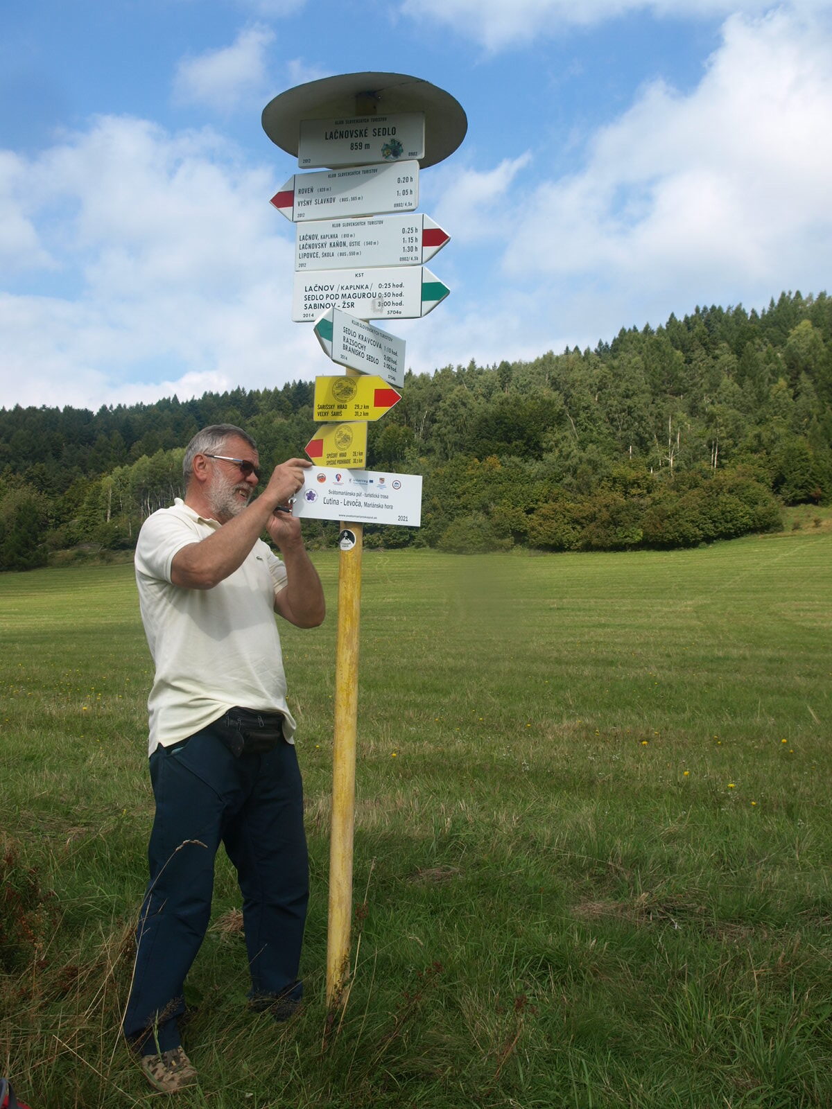
Ernest Rusnák, an experienced marker and chairman of the Regional Council of the Slovak Tourist Club Levočské vrchy-Branisko, was the organizer of the route marking.
"The actual marking began in mid-July on the ridge of the Levoča Hills. Most of my time was taken up by the signs, which I had to mount on signposts often accessible only by my own, in some cases as far as two hours on foot, the same time on the way back. These were, for example, the Pusta signposts on the border with the Polish Republic, then the signpost in the Lysina saddle in the Čergov Mountains, at Branisko pod Smrekovicou, in the Kravcová meadow and in the Humence saddle. In the Bachureň Mountains there were longer routes to the saddle below Kohut, to the Močiare signpost, to Marduňa in the Bachureň Mountains. In the Levoča Mountains, as I know them well, I have, with few exceptions, reached almost everywhere by car or electric scooter. Other valleys were also accessible by car."
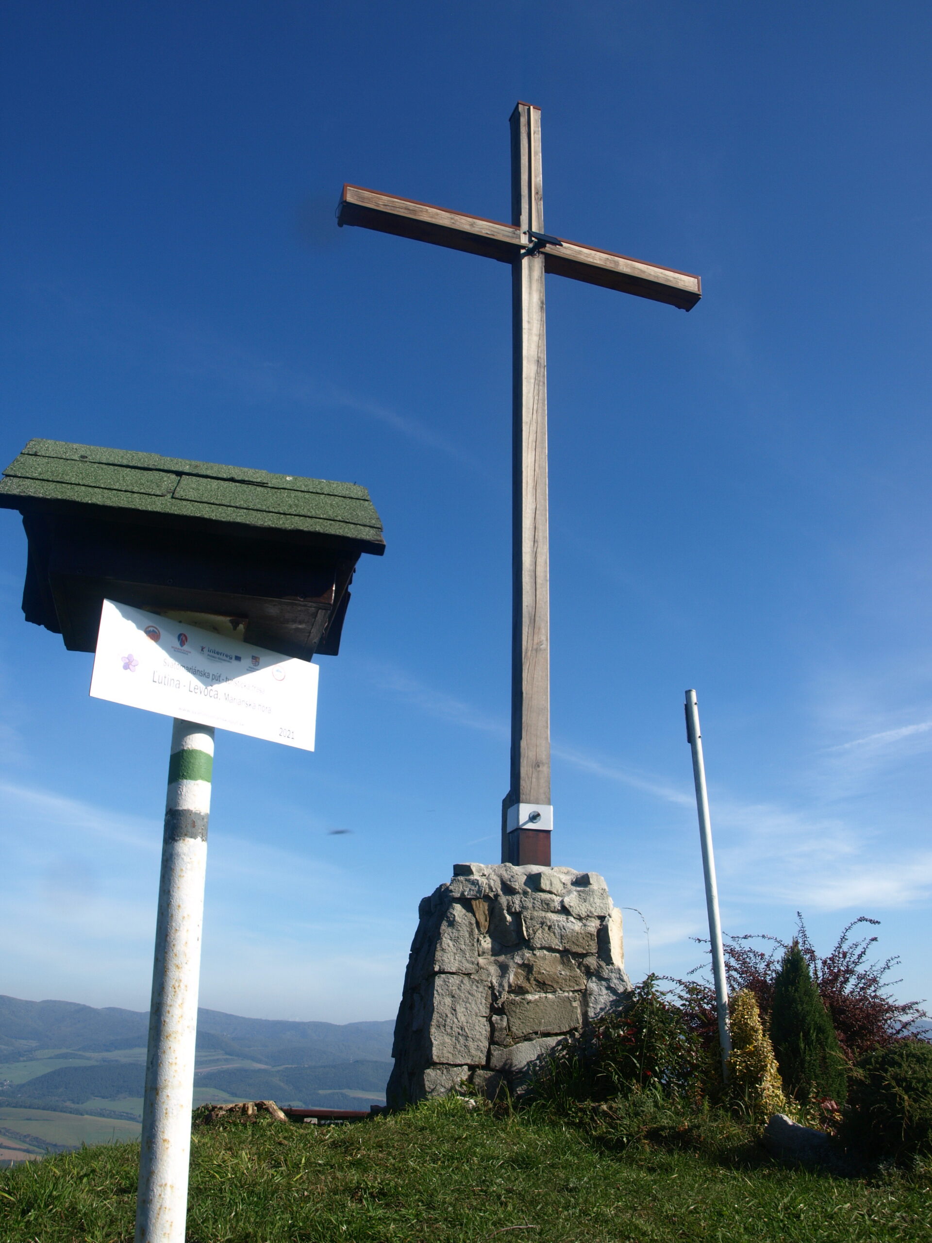
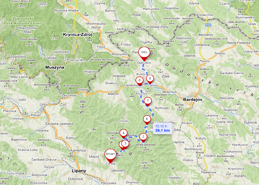
The marking was carried out by means of 86 donor plates approved according to the relevant KST standard. The route also takes pilgrims through the natural beauties of the Prešov region, such as the Lačnov Canyon, Rajtopíky and the famous mountains with captivating views - Branisko, Bachureň, Spišská Magura or Čergov. Part of the pilgrimage is also situated in the Subcarpathian Voivodeship between the pilgrimage sites of Litmanova and Gaboltov.

Marking of the pilgrimage route within the framework of the St. Mary's Pilgrimage project ("Light from the East") was one of the many activities of the KOCR Northeast of Slovakia, which contributed to to start pilgrimage tourism in the Slovak-Polish border area. It has also prepared a mobile application, a booklet, pilgrim passports and promotional materials for pilgrims. Perhaps the most impressive output of the project within the activities of the KOCR Northeast of Slovakia is the outdoor gallery presenting the St. Mary's tradition in the Prešov Region and the Subcarpathian Voivodeship, which is currently, until mid-May 2022, placed in front of the town hall in Kežmarok.
The flagship project of the Prešov Self-Governing Region, St. Mary's Pilgrimage ("Light from the East"), has been implemented since 2017 within the framework of the cross-border programme Interreg V-A Poland - Slovakia 2014-2020. In addition to the main partner, the Prešov Self-Governing Region, a total of 12 entities participated in the project. On the Slovak side, four parishes - Levoča, Ľutina, Gaboltov, Litmanová, as well as the Innovation Partnership Centre and the Regional Tourism Organisation North-East of Slovakia. On the Polish side, it was supported by the Podkarpackie Voivodeship, the John Paul II Institute for Intercultural Dialogue in Krakow and four parishes - Stara Wies, Debowiec, Krosno and Kalwaria Paclawska. Over the duration of the project, more than €2 million has been invested in the infrastructure. Pilgrims have access to information infrastructure, upgraded sanitary facilities, benches, shelters, lighting, etc. in the parishes.
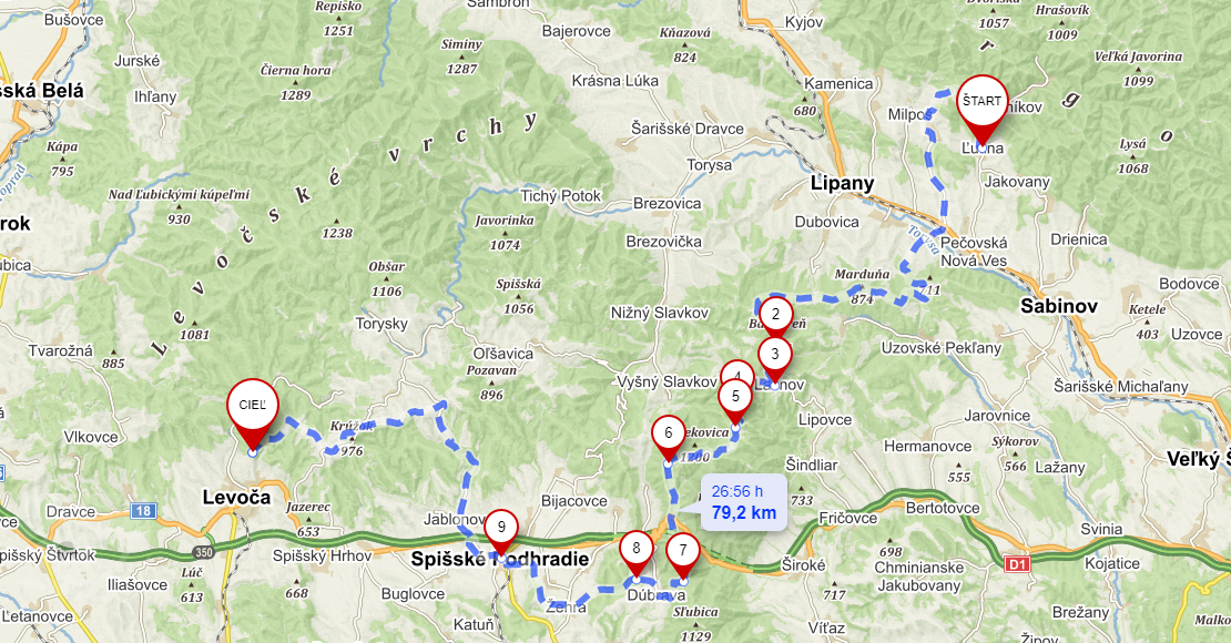
Route Ľutina - Levoča
Ľutina - Hanigovce - Červenica near Sabinov - Sedlo pod Kohútom - Močiare - Marduňa - Sedlo pod Marduňou - Sedlo pod Bachurňou - Sedlo pod Magurou - Lačnovské sedlo - Pod Kravcovou - Sedlo Smrekovica - Sedlo Branisko - Sedlo Humence - Dúbrava - Spišský hrad - Spišská Kapitula - Spišský salaš - Lúčka - Nad Pavľanmi - Krúžok - Uloža - Kúty - Mariánska hora
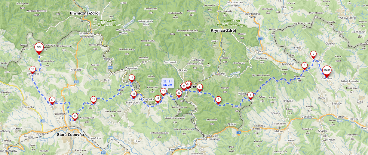
Route Levoča - Litmanová
Mariánska hora - Levočská dolina - Zbojnícka lúka - Sedlo pod Krížovým vrchom - Kozí hrb - Memorial of the Slovak National Uprising - Vinná - Sedlo pod Škapovou - Malý Václavák - Krumlov - Kotník - Hniezdnianske sedlo - Stará Ľubovňa - Pasterník - Vabec - Jarabina - Litmanová Hora Zvir

Route Litmanová - Gaboltov
Litmanová Hora Zvir - Litmanová - Jarabina - Vabec - Pasterník - Ľubovniansky hrad - Osly - Hlinská - Sliboň sev. úbočie - Rázc. State border - Malý Lipník - Starina - Legnava - Borysów - Muszyna - Stadlo - Garby - Wojkowa - Kráľová studňa, border - Puszta - Kurovské sedlo - Petrová - Sveržov - Gaboltov
Route Gaboltov - Ľutina
Gaboltov - Sveržov - Kružlov - Bogliarka - Križe - Sedlo Lysina - Solisko - Sedlo Priehyba - majda rázc. - Olejníkov - Ľutina
Author František Baláž, KOCR SVS


